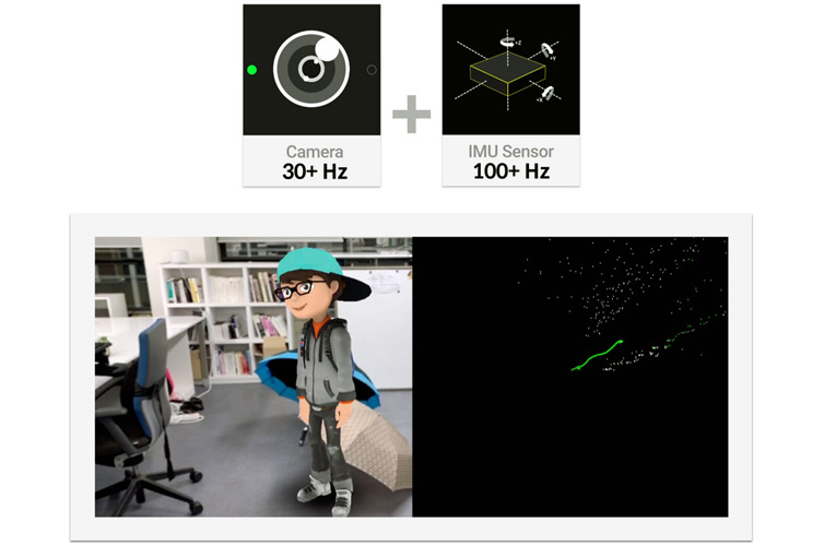
MAXST, the city-scale augmented reality platform has the newest addition in the family in the form of ‘Sensor Fusion SLAM’ solution that integrates the use of a camera with IMU (Inertial Measurement Unit) sensor. ‘Sensor Fusion SLAM’ technology does not require a LiDAR and ensures to outperform technologies such as ORB-SLAM2 and VinsMono SLAM as suggested in the EuroC benchmark.
It is the only SLAM technology that runs on mobile in real-time. Its map saving function is applied to various domains including indoor navigation. It accurately tracks objects using data collected with gyroscope and accelerometer in the IMU sensor to operate meticulously. Besides, it tracks the fast movement of a device precisely by merging a camera with an IMU Sensor, enables On-the-Spot Rotation in which a camera pivots within a given spatial realm and tracks an object with precision.
Features of MAXST Sensor Fusion SLAM
- Smart Glasses Ready: It integrates on various Smart Glasses and minimizes MTP (Motion-to Photon) latency to deliver immersive AR experience to users.
- Geometry Extraction and Measurement: It instantly detects planes on a screen and measures a distance between two points with less than a 3% error.
- Map Sharing: It constructs a 3D indoor map using MAXST Visual SLAM Tool and quickly recovers the current location on the map.
Because of its tracking accuracy and precision, SLAM technology is used in industries that utilize smart glasses, robots, and drones.
- Mobile: It enables developers to support both iOS and Android with a unified API. Mobile Devices that not using iOS or Android will be supported with verified SLAM technology by MAXST Sensor Fusion SLAM, without the need to further develop SLAM technology from the beginning.
- Wearable: It provides verified SLAM technology on HMD (Head Mounted Display) devices. Minimizes MTP (Motion-to-Photon) latency and further minimizes for devices supporting ATW (Asynchronous Time Warp), users can dive into immersive yet interactive AR experiences.
- Robot: Mounted with MAXST Sensor Fusion SLAM, robots will be capable of navigating through various environments, and reconstruct the external surroundings via 3D reconstruction mapping.
- Drone: By utilizing GPS and MAXST Sensor Fusion SLAM simultaneously, drones will be capable of navigating with precision, as they reconstruct their environment in 3D mapping via SLAM technology.

